We are pretty pumped for ski season and our new Mac computer, so we had to make a little ski video. The footage is from a day at Summit Ridge in Waterton last spring. We didn't have the best video and most photos, but making the video still got us excited! Hopefully this is the first of many videos to come this winter!
http://www.youtube.com/watch?v=c0OUlrJNK74
(I am trying to embed this - I doesn't seem to want to work)
Tuesday, September 16, 2008
Monday, September 08, 2008
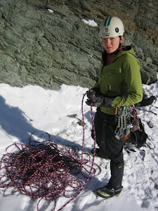
Bears in the Bushwhack
I was tired and frustrated. The inch-thick branches had wrapped around my legs tighter than teenagers at Inspiration Point, and I felt myself sinking into the dark underbrush.
“What are you doing?” exclaimed my boyfriend Brad, as I lay there stuck in a pose reminiscent of something seen in a Christina Aguileria video. I closed my eyes and sighed, unable to move. I needed to remind myself why I had signed up to brave this bushwhack to scramble up Mount Cleveland.
Mount Cleveland is the highest peak in the Glacier National Park – the pinnacle of the area oft referred to as the “Crown of the Continent”. The summit stands at 10,466 feet, and while it does not compare in height to other peaks in the Rockies it is by no means lacking in stature. The north face of Mt. Cleveland is largest vertical relief in the Lower 48 – dropping over 4000 feet. By comparison, the imposing face of El Cap rises 3,500 feet from the valley while the Sears Tower is a measly 1,730 feet.

No trail leads to the base of the mountain, making the journey above the tree line imposing in itself. As a result, most routes up Cleveland require a two day trip. The adventure begins pleasantly with a boat ride starting in Canada at the Waterton town site and finishing in the U.S.A. at the Goat Haunt Ranger station. Most tourists leave the shelter of the tour boat for only few minutes to snap some photos, but for prospective Cleveland summiteers the journey only begins here. From here one must gain nearly 6,000 feet of elevation to reach the top of the peak. This climb up the West Face is spread over 9 miles, but only two of those are via an established trail. Cleveland has been done in a single day on numerous occasions, but the trip is surely not for the faint-hearted.
We were attempting the peak en masse in a group of five. Jollin had organized the bulk of the logistics. Trevor had also done a significant amount of research into the peak. James seemed to prefer to rely on the guidebook and his intuition to get us up the slopes. Brad and I were somewhat last minute additions to the trip, but we were equally as excited to have a chance to bag this peak. We met in the Waterton town site on a Saturday morning, and compared the size of our packs. Brad and I had the smallest packs of all, relying on careful packing to fit everything into our thirty litre packs. James and Jollin were also carrying smaller packs in the 40 litre range, but Trevor was looming under the massive shadow cast by his 70 litre pack.

“You know we’ll be doing a significant amount of bushwhacking, right?” Brad asked.
“Yeah, but I just can never decide what to leave at home. This is an improvement over last year – trust me”. With that reassurance and Trevor’s aspiration to look like a Himalayan Sherpa, we boarded the boat and bid goodbye to Canada.
After an hour long cruise and a barrage of painfully dry jokes, we landed at Goat Haunt. Upon reading our backcountry permit, the park ranger had a few comments that would further complicate the trip:
“You folks trying to head up Cleveland?” she asked.
“Yeah, We’re trying to do the route up the West Face.” I replied.
“Ha!” she chortled, “I’ve seen the slope that the guidebook wants you to bushwhack up. It looks like torture to me – I’ve flagged that “starting point”, but I’d head up Camp Creek if I were you.”
This comment troubled me. The guidebook directed us to leave the trail before Camp Creek, and stated that we’d find an elk trail to follow that would save us hours of bushwhacking through the impenetrable bush near Camp Creek. What now?
We shouldered our packs and began our plod down the trail, chatting excitedly as we each silently stewed over which route to take. Soon we reached the nondescript creek north of Camp Creek where the guidebook suggested that we would find an elk trail to follow through the brush. Jollin and Trevor headed into the bush to try and find the elk trail while Brad, James and I stood on the trail and mulled over our reservations about the bushwhack. After what the Ranger had said, I wanted to have an evaluative look at Camp Creek. And we still hadn’t come across the flagging the ranger had put up to mark the “trail”.
“We’re going to have a look at Camp Creek. We’ll be back in a few minutes” I shouted to Jollin and Trevor. We set off down the trail, all the while looking for the ranger’s flagging tape and listening to Jollin crash through the bush in the distance. Just as we approached Camp Creek, Jollin and Trevor stumbled out of the bush behind us, red faced from both exertion and frustration.

“What the hell are you guys doing?” Jollin panted “You’re driving me crazy!” I attempted to explain that we had only wanted to have a look at Camp Creek before we made a group decision as to where to go. They felt as if we had deserted them in the bush and had decided to blaze our own trail. Apparently the ranger’s comments had not uniformly influenced our route finding choice. Trevor and Jollin were steadfastly committed to following the guidebook and the speculated waypoints they had entered in to their GPS’s. On the other hand, the remaining members of the group thought it might be wiser to use Camp Creek as a navigational handrail into the west bowl below Cleveland. Only after a few minutes of heated discussion and apologies was the decision made to try and follow the guidebook’s description.
Our initial foray into bushwhacking held some promise. After only a few minutes of stumbling through the trees we happened across a well defined trail with a large pile of elk droppings on it. Surely this was the mythical elk trial! We all rejoiced and laughed at ourselves for ever considering going up Camp Creek. But our joy was short lived, and soon the trail faded into brush. The next few hours consisted of an uphill push through near constant brush.
We were a bit nervous as we waded through seas of huckleberry bushes, and called out loudly to avoid any surprise confrontations with a grizzly bear. Bears love to gorge on these berries in the late summer months in order to fatten themselves up for winter. However, these were not the only type of feeding grounds that we were to enter during the trip.
Every summer millions of army cutworm moths migrate from the nearby prairies to feed on nectar from wildflowers found at high elevations in the Rocky Mountains. Just as we enjoy the seasonal treat of strawberries and as the moths seek out the summer nectar of wildflowers, the grizzlies love to munch on the cutworm moths. Studies have shown that grizzlies can consume up to 40,000 moths a day, providing them with nearly 20,000 calories of energy to bank for the winter months. In the dying days of summer and early fall, the moths make the journey back to their flatland homes. We could only hope that this massive migration had begun. The ranger at the trailhead mentioned to us that the record for grizzlies on Cleveland’s summit ridge stood at fourteen. I had not packed nearly that many bear bangers, but maybe Trevor had. We would put him at the front of the group.
The alder branches continued to pressure our bodies into contortionist poses as we tried to navigate through the bush. Thrashing appendages and some choice expletives were required to help me muster the will to keep pushing up the slope. The bushwhack required our full attention to avoid become irreversibly tangled, but the tension that began in our group earlier was only growing.

Jollin broke the silence: “Hey guys, I think we need to start losing elevation. We’re 200 feet above the camp area I have marked in my GPS.” I was dumbfounded. We had been working for hours to gain elevation through the bush, and now he wanted to go down to camp at a spot that he had identified as flat from looking at Google Earth. There was no way that I would be doing this bushwhack again tomorrow on our summit assault, and I was growing tired of “group meetings”. At this meeting we all took our turn outlining our individual plan for the rest of the day. By the time it was my turn to hold the talking stick, Trevor and Jollin had expressed that they wished to camp lower at the flat point on their GPS, and Brad and James wanted to push onward and out of the trees. My non-confrontational self was uneasy at being the deciding vote, but I was happy to be able to break the tie in my favour and decide to push on. A short while later we broke out of the brush and into the alpine of the West Bowl. After the tension and turmoil of our group meetings, we were fortunate to find a perfectly flat campsite in an alpine meadow next to a bubbling creek. We set our tents up in time to watch the late-day sun cast dramatic shadows on the west face of Cleveland.
I had expected the night to be chilly in the alpine, but a warm breeze blew all night. When we stumbled out of the tent at 5 AM, the stars blazed in a sky that had never been hindered by the orange fog of city lights. After breaking camp and caching our overnight gear we were on the trail. We hoped this early start would allow us to reach the summit and retrace our route through the bush in time to catch the 8PM boat back to civilization.
We scampered up a scree ramp to the right of our campsite. Brad and I grunted our way up a snow filled gully while the others followed a broad ridge around the obstacle. We rejoined paths and traversed and across a scree slope onto the west face proper. From here we picked our way through 3500 feet of rock bands. The area is infamous for its poor rock quality, and Cleveland was no exception. We were extra cautious not to launch dictionary sized rocks down on our teammates, as the definition of hurt would be seriously rewritten.

After thrashing through the bush, overcoming group tensions, and tread milling loose scree we arrived at the summit ridge. We were both fortunate and unfortunate that grizzlies were absent from this alpine perch. However, there was no shortage of signs that the powerful animals had recently visited. Giant clawed tracks traversed every snow slope on the peak, and numerous bedding areas could be seen in both the snow and the scree. Perhaps their absence is explained by the disappearance of the summer moths. We saw only one cutworm moth on the trip, and had narrowly missed both their summer stay in the Rockies and the massacre inflicted by grizzlies.
However, the summit was not devoid of the sheer terror and natural wonderment that we would have received from a grizzly bear sighting. First, we experienced the awe of the majestic peaks of Glacier and Waterton National Parks crowding the skyline around us. The truly breathtaking view was made all the better knowing that this summit was earned. We had a truly special viewpoint over an incredibley unique part of the world. Second, the heights were dizzying. I squirmed on my belly to the precipice of the north face, and saw four thousand feet air fall away from me to the valley floor. It was a terrifying void of nothingness, and my nerves were not eased by the increasing winds. We had travelled through the battlegrounds of brush and dissention. Falling rocks had been dodged and hungry bears had been avoided. But as I gazed over the edge, our conquests were forgotten in the face of nature’s power. Mother Nature wins again….
- Mt Cleveland, Glacier National Park, Montana. August 23-24, 2008, All photos available at
http://www.new.facebook.com/album.php?aid=68415&l=0c89e&id=515860972
Tuesday, December 11, 2007
French Kiss - Dec 2
We met up with Jollin and Claudia to check out the Quick and Dirty area's ice. Suprisingly enough, I had never been into this area because of scheduling conflicts in previous years. The weather was finally cooperating for ice as it had been cold all week long.
The walk into the climbs was a dream compared to our previous two weekends of ice climbing - only 15 minutes! We arrived at the base in no time. Brad and I headed to the left most side of the amphitheatre to climb French Kiss, while Jollin & Claudia stuck right on the main Quick & Dirty route. The climbs were very, very wet, In fact, at times it was like standing in the shower as everytime I looked up I got water in my eyes. My gloves were squishy soaked by the end of the route, and the rest of me was equally wet. The lead was fun and varied, although I dropped a tool ahlfway up and had to come down to retrieve it.

After I descended, we pulled the ropes so that Brad could lead the route. This was his most challenging lead on ice to date, and after a case of the Screaming Barfies he reached the top.
We never had a chance to switch routes with Jollin & Claudia, as everyone was wet and ready to go. Another day!
The walk into the climbs was a dream compared to our previous two weekends of ice climbing - only 15 minutes! We arrived at the base in no time. Brad and I headed to the left most side of the amphitheatre to climb French Kiss, while Jollin & Claudia stuck right on the main Quick & Dirty route. The climbs were very, very wet, In fact, at times it was like standing in the shower as everytime I looked up I got water in my eyes. My gloves were squishy soaked by the end of the route, and the rest of me was equally wet. The lead was fun and varied, although I dropped a tool ahlfway up and had to come down to retrieve it.
After I descended, we pulled the ropes so that Brad could lead the route. This was his most challenging lead on ice to date, and after a case of the Screaming Barfies he reached the top.
We never had a chance to switch routes with Jollin & Claudia, as everyone was wet and ready to go. Another day!
Wall Lake - Nov 16-17
Again , early season ice fever had taken hold. And for good reason too! We had scouted the climbs behind Wall Lake in Waterton on a ski tour last January. However, these climbs are threatened by a large avalanche slope so early season ascents are essential. As much as we hoped that our timing was good, the weather had not cooperated. Weeks of warm weather had created marginal conditions for ice climbing.
Brad, Jarred, and I left the car on Friday night with our ice climbing and overnight gear in our packs. We hoped to spend the weekend in the Wall Lake area exploring various smears. Mother Nature had other plans for us. Right from the get-go, things were troubled. As we walked down the now closed Akamina Parkway, it started to rain. The rain continued as we climbed the Akamina pass trail out of the National Park and into BC. This was not our only barrier, as violent winds earlier in the week had blown down many large trees over the trail. After hiking for 2 hours and hurdling 30-40 trees, we arrived on the shores of Wall Lake. We set up the tent and settled in for the night.
In the morning, we woke up and packed up our ice gear with high hopes. It didn't last long though - on our way over to the climbs we heard a loud noise that was unmistakeably the sound of an avalanche roaring over our climbing path. That sound, coupled with the likelihood of encountering unconsolidated mush ice encouraged us to turn around. We abandoned hopes of ice climbing and went back to pack up our tent and sleeping bags.
On our hike out, we ran into Scott and Willis. They continued on to the lake to have a look at the ice, but it wasn't long before they joined us at the Kilmorey for a beer. You can't win them all, eh?
Black and Blue

Yay! Ice climbing season had arrived - or so we hoped. We were desperate to climb some ice, and although it was very early season nothing could deter us. We headed up to K-Country with Willis and Madeline to try and find something that would be formed enough to climb.
After waking up at 4:30 (!), we stumbled into the Library parking lot in Canmore to meet up with Willis & Maddy. It was important for us to get started early to beat the crowds and the forecasted mid day heat. Excited chatter filled the van as we headed out of town on the Spray Lakes Road towards the climb. Before we knew it, we arrived at the intersection with Hwy 40 in K-country. We had accidentally drove 20 minutes past our climb due to our excitement - whoops.
By the time we arrived at the pullout (6:30), two cars were already parked in the darkness. We were a little bummed out by this, but loaded up and started the long walk in to the Trick of Treat area. We had a few difficulties routefinding, and ended up way left of our destination. After traversing across the slope and racing another party we finally arrived at the base of Black & Blue - 4 fours after we had left the van.
Willis took the lead as the route, and dispatching he first pitch of the route easily (4 or 4+). I was sure glad he did, as the steep first section kicked my ass. I wasn't sure I would make it up! Brad led the second pitch, and I headed up after him to set a rappel anchor at the top. Minor frustrations held everyone up, from dropped belay devices to rappells that were 10m too short to reach their destination. We all arrived back on solid ground by 5:00 and packed up to head out.
The walk out was 2 hrs shorter, but it was much more unpleasant with bushwacking and rockhopping in a snow covered creek. It seemed that we would never arrive back at the road, and when we did it was 7:00 - 12 hours after we had set out. That's the price you pay when hunting for early ice!
Everyone was too beat up to head out the next day, so we went to Banff to check out the Mountain Film Festival. A great way to end a great weekend.
Crowsnest Mountain

We headed up to the Pass on September 23 to have a go at scrambling Crowsnest Mountain. We were originally supposed to be in Glacier on a multi-day backpacking trip. However we decided to pull out after a late start, permit hassles, fatigue, and super windy weather. Instead we went to Crowsnest with Jarred, and his brother Jordan & friend Caleb who were visiting as part of a 4 month road trip.
Conditions down low were beautiful for fall. However, as we started to ascend it became more and more winter like. Several frozen scree slopes and snow filled gullies led us to the crux gulley. This gulley is intimidating to some people in the summer, and as a result a chain has been installed to aid with ascending and descending safely. We couldn't find the chain buried in the snow, and so we precariously began our way up the gulley. I was in the lead, trying to clear hand and footholds of snow and ice. It was difficult finidng places to go, and there were several instances where I felt stuck. We finally stopped the chain, and Brad made a ballsy reach across the gap to bring us to a safer route up.
Once we finally reached the top of the gulley, we were only a scree slog away from the summit. By this time we were frozen, and both Jarred and I were almost hypothermic. Dark storm clouds were rolling in, and we turned around and headed down. Although we didn't tag the summer, it was still a fun and successful day. Of course, it was beautiful weather by the time we got back to the car!
Sunday, October 28, 2007
Mount Blakiston
July 21, 2007
This weekend covered some of my few days off this summer. I came home from Cochrane to visit Brad, and we decided to head to Waterton for the day to scramble Mount Blakiston. It is the highest peak in Waterton National Park at 2932m.
We started the day a little later than usual, and were set back a little further when we stopped in Cardston. But hey, who can refuse ice cream at 10 am in July?
We hit the Lineham trailhead at around 11. After 45 minutes of hiking we came out of the trees and had our first look at the spectacular Lineham Falls. The falls are formed as water from the chain of 5 Lineham lakes spills over a cliff's edge. From our viewpoint you could see both the lakes and the falls- making for a spectacular view. After a bit of confusion with the guidebook we settled on the right route. 

Immediately as you come out of the trees and see Lineham Falls, you must start heading up the scree slope and avalanche path to your right. And while it doesn't appear that this insignificant hill could be the highest peak in Waterton, the full magnitude of Blackiston is hidden at this point. The slope wasn't exactly fun to climb. Wallowing up the thick scree was more like walking on an uphill beach than it was hiking. It took alot of sweat and persistence to reach the top of this scree slope. At that point, we began to traverse the ridge to the left and towards the true summit. We soon arrived the the class 4 gully that guards the summit plateau. Brad took the lead on the neon-green lichen covered black rock. I followed close, and we arrived on the summit a few minutes later. Approximately 3.5 hours had passed since we'd left the car.
The views from the top were spectacular. In one direction you could look south and west over the mountains into the States and BC. Only 180 degrees away, beautiful panoramas out on to the Alberta prairies treated your eye. In classic Waterton style, it was very windy on the summit. We didn't stay for long, and soon set out along the ridgeline to complete the "Hawkin's Horseshoe". The route is a continuous ridgeline that links Mounts Blakiston, Hawkins, and Lineham in a horseshoe shape.
 Along the way, we had to navigate a lot more scree. Along the way the scree and rock changed colours, from gold to burgundy to grey to pink. Soon enough, we tagged Mount Hawkins. By the time we got around to Mount Lineham, we decided that it was too late and we were too tired to go for the summit. Instead we descended down the Rowe Tamarack trail and hiked 6 kms along the valley floor back to the Akamina Parkway. After 2 more kms of hiking down the road, we arrived back at the car at 7. It was a long day, and we were hungry for some supper. We'll be back for the whole horseshoe, but next time it will probably be from the opposite direction and at an earlier hour :)
Wednesday, September 05, 2007
Mount Assiniboine

Mount Assiniboine Backpacking
June 23 – 24, 2007
As I was away for most of the spring, and would soon be leaving for the entire summer, it was important to squeeze in another awesome trip before it was too late. This was my last available weekend to spend with Brad before heading to work at the cadet camp, and initially our plan was to climb a multi-pitch route or two on Kid Goat near Canmore. However, after our great weekend at Cracker Lake the week before we both agreed that another weekend of backpacking would be ideal. After that decision was made, picking an objective was easy. Both of us really wanted to see Mount Assiniboine because we’d frequently read about its stunning beauty. Mount Assiniboine is considered the “Queen” of the Southern Rockies because it towers over all of the other peaks around it. It also has a symmetrical pyramid shape, drawing comparisons with the famed Matterhorn in Europe. That was enough to motivate us to make the 50km+ round trip in two days.
The trip started late on Friday afternoon, as Brad had to work and I had to finish up a final for my spring classes. We drove to Calgary, and after an obligatory stop at MEC, we were headed towards the mountains. We took two vehicles as I would be leaving straight for camp following the weekend. After parking my car at the library in Canmore, we drove out of town on the windy and bumpy Spray Lakes Road. Our drive out to the trailhead at Mount Shark, while dusty, was also filled with animal sightings. Because it was nearly nine and the sun was going down, all of the animals were out and about. We saw rabbits, elk, and deer. We also almost hit a young black bear as it came barrelling out of the trees and across the road. In order to get the driving out of the way, we decided to set up camp right at the trailhead. And while this was probably not allowed, I figured that we would start the day early enough to avoid getting caught. We parked the truck, brushed the dust off our packs, and set up the tent. Within twenty minutes, we were comfortably resting in our sleeping bags.

In order to get a good start on the 25+kms that we had to cover, we got up early. After a hurried breakfast and a double check of our packs, we were walking. The quickest and most popular way into Mount Assiniboine begins at the Mount Shark cross country ski trails, heading due west into Banff National Park. Continuing west, you’ll then head over Assiniboine Pass, and cross the border into B.C. and Mount Assiniboine Porvincial Park. For the first leg of the trip, the trail was wide and mostly flat. We cruised through the first 13 kms in 2.5 hrs, and found ourselves at the Bryant Creek warden cabin. This also marked the spot where the trail left the trees into an open alpine meadow. The views in this valley were stunning, and for the next 7 kms we were treated to huge limestone faces, delicate wildflowers and cascading waterfalls. The trail also became more interesting, as many parts had turned into mini creeks due to the melting snow pack. Luckily, detour trails had already been blazed, so we managed to get through without any wet boots. Soon enough, we began the climb up and over Assiniboine Pass. We gained about 300m in elevation over three kilometres as the trail wound its way up the hillside. Before we knew it, we had reached the top. We broke for a quick lunch at the summit before continuing on. From here, we had about 4 kms of downhill travel to arrive at the base of Lake Magog, where we would spend the night. Because we were now at a fairly high altitude (2100m), and it was still early in the season, there was quite a bit of snow left up top. It didn’t present too much of a problem, but on more than a few instances, we sunk up to our knees after a poorly placed step. So far, Mount Assiniboine had been elusive. But as we came down and around the final corner, we saw our first view of her. The peak was more impressive than I had imagined it would be. Above Lake Magog, a glacier hung in a meadow. Immediately to its left, Mount Assiniboine rose out of the ice as an equilateral and imposing pyramid. The peak still had a fair amount of snow on it, and the contrast between the white snow and dark rock only added to its stature.
At 1:45 we arrived at Mount Assiniboine Lodge, 5 hours and 45 minutes after setting out. We were treated by the staff to warm, fresh cookies, which was an awesome way to finish a long hike! After hearing that our intended campground was under knee-deep slush, we opted to stay in the Naiset Huts for the evening. These unfinished, rackety shacks didn’t appeal to the high end tourists at the lodge, but they were a luxury to us. Within a few minutes, we were stretched out in the sun on our “porch”, reading magazines and eating cookies. Later, we also opted to go for camper’s tea at the lodge From it’s deck, we enjoyed hot tea, fresh loaves, and great late afternoon views of Assiniboine. After a long walk around Lake Magog, we headed back to cook supper. Brad made a delicious cous cous concoction for dinner, and we sat in the cook shack and visited with an Australian couple who we’d met at the campsite. There stories were interesting, as they’d travelled nearly everywhere – including nine months spent in Africa living out of a Land Rover. By the time we’d eaten and cleaned up, we were ready for bed.
 In the morning we were up early again, and quickly prepped for the hike back out. We hit the trail at around 7:30, and were soon up and over Assiniboine Pass and back into Alberta. The hike out went quickly, but towards the end our pace began to drag a little. My feet were blistered and sore from the distance travelled, and the last 5 kms was especially tedious. We arrived at the trailhead around 2PM, making the return trip in 5.5 hrs.
While the trail was flat and gentle most of the time, the distance we had travelled over two days had taken its toll on our bodies. We climbed into the truck tired and aching, but also satisfied at having accomplished another one of the goals on our hit list. A successful weekend all around!
Sunday, June 17, 2007
Cracker Lake!
June 16/17, 2007
Glacier National Park, Montana
Glacier National Park, Montana

Brad & I at Cracker Lake
It had been a little while since we'd gotten out for some backcountry adventure, and as summer drew closer the number of weekends available for a trip became fewer. Since we'd never been there, Brad and I decided to head to Glacier National Park for the weekend.We left town on Friday night, and just under two hours later we were setting up camp at the Many Glacier campground. This weekend would be the first time trying out my new tent and Brad's new sleeping bag and pot set- new gear is always fun! Because the border guards had confiscated our salami and we hadn't planned for anything else, we went shopping for supper. A half hour and a weird conversation with a clerk later, we were frying up hot dogs. A culinary delight. We took a short walk (4km) up the Swiftcurrent Pass valley after supper, and happened upon a moose at Fishercap Lake. It didn't seem too concerned with us watching it muck around in the water for a few minutes. We continued on, and managed to snap quite a few nice photos. Photos were important to us this weekend because of the lack of summer pictures in our collection. Believe me, we took lots! Soon enough, we tucked into the tent for the evening to read guidebooks and go to sleep.
When morning came, I headed to the ranger station to see about a backcountry camping permit for the evening. Our original plan was to hike to Poia Lake, set up camp, and then day hike from there. However, that campground was full and we got a permit for Cracker Lake instead. It was no loss as we'd heard it was beautiful. After some delays at the ranger station, and having to suffer through a 15 minute backcountry awareness video, we headed to the trailhead. We were hiking by 10am.
The hike into Cracker Lake is a 6 mile (9.7ish kms) trip. It was a pretty hike that started in the trees before heading up into the alpine. There was one set of switchbacks on the trail, but no real crazy elavation gain (300 m). Along the way, we met a nice park ranger who was out investigating reports of a grizzly sighting. She didn't find what she was looking for, but we found answers to a lot of our questions about the park! As we hiked on, clouds rolled in and it started to lightly rain. We kept a good pace and arrived at Cracker Lake in 2.5 hrs. We didn't see any wildlife along the way, but there were fresh digging marks from bears along the trail that made us nervous at times.
A
 s we set up camp, the skies really opened up. We ate a hurried lunch in the tent, and when the rain subsided we headed out to explore the area. Cracker Lake is the colour of "Blue Raspberry KoolAid" - typical of glacial fed mountain lakes. It is framed on all sides by steep mountains, and is cordoned off by Mt.Siyeh and the Siyeh Glacier from the rear. We hiked out towards the glacier to explore for the afternoon. We climbed over the gravel moraines, up a snow slope and then down onto Siyeh Glacier. There's not much ice left here, and the glacier is more akin to a residual snow field. We played around for a few hours on the hillside, visiting a waterfalls and taking pictures. Brad was also determined to find a mountain goat that would "apprentice" him, but aside from fur stuck on branches we had no luck. Around 5 o clock we headed back to camp, but along the way stopped in to visit an old mine site. It must have been a lot of work to dig that out so far away from civilization!
We made ourselves some supper, and sipped red wine from the "tetra pak" style box wine we'd bought the day earlier. We had no cups, so we had to drink right from the wine juice box. Classy. Since we'd neglected to bring any reading material, the only thing to do was to sit around and admire the view. It was not a bad thing to be stuck doing.

It started to rain again, so we headed to the tent to get ready for bed. After looking through the day's pictures, we drifted in and out of sleep. During the night a major storm rolled in, and on several occassions hard rains woke us. Thankfully, the tent was of sound construction and kept us bone dry (yeah!). However, when we woke up in the morning the winds had picked up and were threatening to collapse the tent walls. The weather was crazy, with gale force winds driving snow parallel to the ground. We packed up hurriedly and carefully, and didn't bother trying to light the stove for oatmeal. It was at this time that Brad discovered that the campground's resident marmot had visited us during the night and chewed on the padding of his pack. Luckily the damage wasn't too severe, or we'd have had marmot for breakfast instead!
The weather eased as we hiked out, but it still rained steadily the whole way. We were back at the car 2hrs and 15 mins after setting out from Cracker Lake. Everything was pretty wet, but luckily we'd stayed pretty dry because of our hardshells and gaiters. All in all, while the weather wasn't ideal for some it was perfect for us. It didn't get in the way of the weekend, and allowed us to test the limits of some of our gear. Smiles and success all around!
Sunday, May 06, 2007
Red Rocks Trip

For those of you who didn't know, I went climbing at the Red Rocks area near Las Vegas for a week and a half over Christmas break. It was pretty awesome, except for the storm that drove sand into every inch of my car, clothes, and body. It even stole a shoe from me!
Anyway, photos from the trip are posted on my Facebook:
There aren't many on there, but that's cause I just didn't take my camera with me that often. Somebody out there has some pictures of me climbing.....
Subscribe to:
Posts (Atom)